 | |
| Byward Market — Dalhousie & George looking east, July 2016 |
Saturday, 2 July 2016
To Loom

Sunday Morning Vanier
 |
| 105 Vachon, June 2016 |
 |
| 35 Laval, June 2016 |
 |
| 75 Vachon, June 2016 |
 |
| 29 Charlevoix, June 2016 |
Sunday, 12 June 2016
It's full of holes
 |
| digging on Gilmour, June 2016 |
This slice of the Golden Triangle lies just to the north of what was once called Neville's Point (see Urbsite.) This small settlement sprang up near the mouth of Neville's Creek. Apparently the creek was a slow, seasonal affair but in its time it managed to carve a respectable gully before emptying into the Canal, warranting its own little wooden footbridge (see Lost Ottawa, extreme right end of map.) You can still see a relict depression in the ground where the creek once flowed — it lies in the grassy area between the German Embassy (#1 Waverly) and the Canadian Nurses Association (#50 The Driveway). The depression extends back "upstream" to make a small dip in Robert Street near #26.

It's fair to guess that exposed the soil in the photo is the sort of stuff Neville's Creek would have been cutting its way through. From here, it looks silty to me, maybe on the sandy side with some clay. According to the "Surficial Geology of Ottawa" map 1506A, Geological Survey of Canada, this spot is covered by Champlain Sea sediments of type "3a" described as...
Clay and silt underlying erosional terraces; upper part of marine deposits removed to variable depths by fluvial erosion so in places clay is uniform blue-grey; unit includes lenses, bars and channel fills of sand and pockets of non-marine silt that was formed during terrace or channel cutting.So yeah, though that rocky-looking layer dipping downward to the right at the far end of the pit has me flummoxed — or is it old, sunken pavement?) I'm also intrigued by the gravelly layer under the sidewalk. What is that — old macadam? Or was the sidewalk poured over a (deep!) gravel bed?
For a detailed discussion of this part of Centretown, see Urbsite's article on "The Bend in the Deep Cut." Also, Google has archived a fascinating piece from the Ottawa Citizen dating to 1935. It's introduction (rampant capitals not mine) reads...
Story of Seventies Related by Charles Neville. Tells of Deep Gully Which Ran From Elgin to Foot of Waverley. Women Worked in Bare Feet in Brickyards On Canal Bank. Extensive Area Between Elgin and Bank Street Was Veritable[*] Swamp. Recalls Old "Rampike" in Canal.Read all about it here!
(*@Kevin "ORLY?")
Friday, 10 June 2016
The Theatah — The Dahnse...
 |
| renovations begun at the National Arts Centre, as seen from Elgin Street, June 2016 |
 | ||
| Old Old City Hall, old postcard |
It seems odd (pathetic?) now, but in the mid-sixties, Ottawa's most spectacular live entertainment (short of the hippies on Sparks Street) was probably the Changing of the Guard. After watching that, you could take an elevator to the top of the Peace Tower and imagine what it would be like to jump off. And back then, you could.
Touring live acts bypassed Ottawa in droves. Orchestras, ballets and major rock musicians routinely played Toronto and Montreal — but not here. We were a small audience with a paucity of decent venues. We all remember Hendrix playing the vaudeville stage of the Capital Theatre precisely because he was the exception to the rule (and of course, because he was Hendrix.) Then there was Bob Dylan who, after his 1966 concert at The Auditorium*, dismissed Ottawa as as "the worst, terrible, miserable hole in the entire Universe." In fairness, some sources insist that he actually called our city a "dirty, rotten stinking hole." A hole, in any event...
That began to change in 1969. As soon as it opened, the NAC was the place to see and be seen. People actually read and discussed the reviews of the high profile Canadian and international acts that took to one of its three stages, the Opera, the Theatre and the Salon. Typical of the time is this review of a 1970 performance by the Royal Winnipeg Ballet. Oddly, I barely remember the musical contribution of Lighthouse (apart from the band's sheer loudness) — but an unplanned aerial performance by at first one, then two large and graceful bats who happened into the Opera, remains vivid.
Such "highbrow" culture may not have the cachet it did some forty-seven years ago, but the NAC is still home to a prestigious symphony orchestra and two theatre companies, and it regularly hosts international dance companies and touring musicals.
As you can see from my photo, the building is a bit of a mess at the moment, as is everything else in Ottawa. Current renovations will see a windowed facade installed over the northwest terrace. In preparation, sections of precast cladding have been removed, revealing the massive poured/reinforced concrete structure underneath. The cladding is studded with colourful Laurentian granite aggregate. If memory serves, the concrete supplier was Francon (formerly Ottawa Pre-Mixed Ltd.) The aggregate would have come from Francon's Shawville gravel pit.
This sequence of aerial photos shows our first City Hall (top image, "CH") in 1928, followed by some massive NAC site preparation dating to 1965. The bottom image is from 2011 and is a good representation of the facility ahead of this summer's renovations. Click to view full sized.
 |
| NAC site and environs 1928-1965-2011, image source geoOttawa |
*The Auditorium, built as an indoor ice rink in 1923, sat at the corner of Argyle and O'Connor. Its final event was held on October 1, 1967 — a concert by Guy Lombardo and his Royal Canadians. The building was demolished and replaced by a YMCA complex. The Ottawa Civic Centre opened in December that same year and established itself as the venue of choice for large, touring rock acts.
Thursday, 2 June 2016
the Long Vacancy: 490 Wilbrod
 |
| the vacant lot on the southwest corner of Charlotte at Wilbrod, Sandy Hill |
I have only the vaguest memory of seeing the smouldering remains of #490, a little over twenty years ago. I can't recall the exact time of year of the fire nor can I find a news account of the event. I have however, found a helpful passage in a meeting agenda (full document here) for Ottawa's Local Architectural Conservation Advisory Committee dated October 17 2000. On page 2 we find the following...
New construction for 490 Wilbrod Street (Document 1) was first proposed in the summer of 1998, as a replacement for a late-19th century Queen Anne Revival-style house destroyed by fire in 1994 but objections to the size and character of the proposed development brought forward at community meetings and at the Committee of Adjustment resulted in its dismissal.The document goes on to describe the proposed flat-roofed, four-storey, fourteen unit building in flattering detail, noting that "...the Department supports this project because it evokes the character of the existing older apartment buildings that characterize Charlotte Street near Wilbrod Street." Detailed drawings of the proposed building are included.
In early 2000, the applicant brought the project to the Committee of Adjustment again and was again refused. This summer, in order to resolve the differences between the applicant and the community, the Planning Branch organized facilitated sessions with City staff, the Ward Councillor, Action Sandy Hill, adjacent neighbours, the developer, his architect and agent to work out a design that was acceptable to all. The application being considered here is the result of the facilitated sessions... [emphasis mine]
Twenty-two years after the fire, the lot remains empty.
Here's an aerial photo-comparison, made with images from geoOttawa. (Click to view large.)
 |
| 490 Wilbrod St, Sandy Hill — 1991-2009 |
The Advisory Committee document describes #490 as "late 19th century." The Goad fire insurance maps show this to be true, albeit about as late in the 19th as it gets.
 |
| Charlotte between Wilbrod and Laurier, Goad, October1898 |
You may recognise the shape of the building at the bottom right of the image as that of Le Cordon Bleu — or if you've been around for a while, Le Cercle Universitaire at 453 Laurier. In January of 2000, Ottawa Business Journal offered this summation the house's history on the event of its sale to Le Cordon Bleu (full article here.)
Built in 1877, the majestic and stately Le Cercle features Tudor and Baronial-Gothic architectural influences and was a twin to what is now the Laurier House museum.
Originally designed as a private residence for the family of Bytown lumber baron John Mather, the building remained a private residence for a succession of owners until 1940. From 1948 to 1958, the building was used as a residence for the Women's Royal Canadian Navy Service (WRENS) and students from the University of Ottawa and St. Paul's University. Le Cercle Universitaire was established at 453 Laurier Avenue East in 1958.
 |
| 453 Laurier, "Munross Mansion" via ottawa.ca |
But lets wander back to Wilbrod. Notice how #490's footprint is nearly identical to that of its Charlotte St neighbours — simply rotated by 90 degrees to face onto Wilbrod. It's a likely bet that the three houses were the work of the same architect/developer, building the trio at the same time. Work could have started in 1897, with the Charlotte-facing houses completed by Christmas of '98, while #490 could have been ready for occupancy by spring or summer of 1899. Of course, I'm guesstimating these dates but the point is, yes, late 19th century.
This detail from Goad (1912) shows us the Charlotte-Wilbrod intersection in its glory days...
 |
| Charlotte and Wilbrod, Sandy Hill circa 1912 per Goad |
The similarity between the three houses is undeniable, though #490 seems to be of more modest scale than its siblings. Also, notice 488 Wilbrod, as seen in our photo at the top of this post, boasting full brick construction set on a magnificent "stone 1st" storey. That building is now home to Ottawa's Amethyst House.
I haven't researched #490's occupancy in detail, but a few interesting characters have turned up. We should remember that during the 19th century, Sandy Hill evolved from forest, to farmland, to Ottawa's most prestigious neighbourhood — usurping that role from Upper Town before loosing it to Rockcliffe Village in the early 20th century. The dying days of the 19th saw building of the last of the big houses on the northern plateau — Sandy Hill was still the place to live.
One of (if not the) first occupants of 490 was Edward R. Cameron (per the City Directory of 1901.) Active as an author and lawyer in the latter half of the 19th, Cameron was eventually named King's Counsel — (after Victoria's death, one would think?) A 1914 listing describes him as Registrar for the Supreme Court of Canada. He and his wife maintained a summer house at Blue Sea Lake.
The directories show Mrs Emily P. Arnoldi living at #490 in 1909. She was the widow of the noted architect King McCord Arnoldi. By 1912 Emily had moved across the street to 483 Wilbrod (now the parking lot of the Vimy Apartments.) She was replaced at 490 by a Mrs Julia Gwynne. I am tempted to say that she was Julia Maude Gwynne, wife or widow of surveyor and rail engineer (the kind who designs railways), Sir Collingwood Schreiber. Schreiber died in 1918 so I'm not sure what to think — did he and Julia divorce, or simply misplace each other?
 |
| Sir Arthur G. Doughty |
* * *
I'm just back from a short visit to the OPL. As I sat squinting at the tiny lettering on the darkly coloured pages of the Ottawa Directory for 1993-94 — the year of the fire — a very old man at the table next to mine ate his lunch and read newspapers, all the while making sounds like a small ghost dying from a broken heart. This distraction notwithstanding, I was able to find the listing for 490 Wilbrod. It read, simply, "BOARDING HOUSE" — followed by a telephone number. I hope no-one was hurt in the blaze.
The image below was adapted from a Google Street View capture, taken just over a year ago, roughly from in front of the Russian Embassy. Not only does Google's shot reveal the sheer, gaping vacancy of the lot, it gives us a view of 278 Charlotte (on the left) which would have been built a year or less before 490 Wilbrod, in the same style (Queen Anne revival, I think) with a near identical layout. The Vimy Apartments sit of to the right of the image. Going by the name, one assumes they were built some time after the battle of Vimy Ridge, April 1917.
 |
| 278 Charlotte and environs, spring 2015, adapted from Google. |
Sunday, 22 May 2016
Malachite and Salmon
 |
| 644 rue de l'Eglise, Ottawa |
It's heartening to see how a splash of paint, a cared-for lawn, two planters and a handful of shrubs can bring such charm to an otherwise modest building.
#644 is one of three identical six-unit blocks on rue de l'Eglise — its companions, 650 and 656 sit immediately to its right (you can see part of 650 on the left-hand edge of the photo) about a block south of Montreal Road. They were built some time between 1956 and 1958, part of a local post-war boom in affordable rental housing which saw the development of nearby Manor Park, Rockledge Terrace, Overbrook, and Eastview.
And yes, I did mean to say "nearby" Eastview. De l'Eglise ("of the Church"), was named for Eastview's graceful Notre Dame Church* which stood at its north end, but the street never actually lay within the historic Eastview/Vanier city limits.
The Village of Eastview was founded in 1908, combining the communities of Clandeboye, Clarkstown and Janeville. It became a town in 1913 and a city in 1963. In 1969 it was renamed Vanier to honour the recently deceased Governor General, Georges Vanier. The city became part of Ottawa under the 2001 amalgamation.
The poorly understood borders of this former city-within-a-city are discussed in a post at VanierNow, sensibly titled "The Borders of Vanier." It begins...
Until Vanier’s amalgamation with Ottawa in 2001, the boundaries of this one square mile had remained constant since 1909. Yet (even after nearly 100 years) few people, if put on the spot, could draw Vanier’s outer edges correctly. Today, despite amalgamation, while the Vanier neighbourhood remains firmly imprinted within Ottawa, its precise boundaries remain elusive to many...I've marked the north end of de l'Eglise and #644 ("X") in red, on a 1970s map of Vanier hosted by VanierNow. Notre Dame Church is shown in green. (Click to enlarge.)


Most Ottawans think of Vanier as being bounded on the east by St. Laurent Blvd, but apparently this was never the case. The city's southern half was contained by a line running from Ducharme Blvd at Montreal Road down to Belisle St at McArthur — never closer to St. Laurent than some 580 metres.
From Montreal Road at Ducharme, the border ran east just past the grounds of Notre Dame de Lourdes Church, still 280 metres short of St. Laurent. And there it hung a left directly into Notre Dame Cemetery.
Presumeably, this gerrymander made perfect sense to someone at the time, but it effectively cut the graveyard into two sections, one in then-Eastview and one in Ottawa. Thankfully, both church and cemetery now sit entirely in the same ward — #13, Rideau-Rockcliffe. Oh but look — according to geoOttawa, the Notre Dame Grotto, once the gem of church grounds, is now part of ward #12, Rideau-Vanier, hidden behind a high-rise and a cluster of row houses.

Sitting just east of Vanier, de l'Eglise (formerly "Church Avenue") was indeed part of the City of Ottawa when #644 was built. By then Ottawa extended as far east as Blair Road (then "Skead") — Eastview/Vanier was truly a city inside a city.
As to that sliver of Ottawa between Ducharme and St. Laurent, some call it Castle Heights. It sort of bleeds into Overbrook toward the south. Some even claim that the Heights cross St. Laurent, stretching even further east, while others call that land Forbes. Whatever — just don't call it Vanier.
* * *
Anyone researching the history of Eastview/Vanier should note that while de l'Eglise was originally called "Church Avenue," there was another road of the same name in the northern part of Eastview "proper." Oddly I can find no indication that it ever featured a church. It was eventually renamed St. Jacques.
*The original stone church was built in 1887-88, designed by the Canon Bouillon who patterned it after the Basilica of Notre-Dame-de-Lourdes in France. It was destroyed by fire in May of 1973, along with the adjoining St. Jean Scholasticate (1901). There were no deaths or injuries, but all documents, including the books in the Scholasticate library as well as the archives, were lost. Only the church’s bells were recovered from the ashes, and they were subsequently incorporated into a new church, built in 1975 at the site of the original.
 |
| Ottawa City Directory |
*The original stone church was built in 1887-88, designed by the Canon Bouillon who patterned it after the Basilica of Notre-Dame-de-Lourdes in France. It was destroyed by fire in May of 1973, along with the adjoining St. Jean Scholasticate (1901). There were no deaths or injuries, but all documents, including the books in the Scholasticate library as well as the archives, were lost. Only the church’s bells were recovered from the ashes, and they were subsequently incorporated into a new church, built in 1975 at the site of the original.
Thursday, 19 May 2016
Taisho-era House
 | |
| photo-comparison from "the Taisho photographer's house" by Hamish Campbell |
Of these images, Campbell writes...
In a secluded bamboo grove in northern Japan, I stumbled across an old family homestead. On site were over 200 glass plate negatives dating back to the Taisho era of Japan [the Emperor Taishō, reigned 1912-1926] showing the construction of the house and the lives of those who lived there for many years. In these images the passage of time is both clearly evident and a blurred line, as we see the house both as a busy family nexus and a quiet companion to nature as it is returns to the earth. Exhibited at Artsite Gallery, Sydney, from May 7th-29th 2016.Selected images from this series can be viewed at the photographer's website. Additional discussion appears at Petapixel.
While many of the images in Campbell's trove feature domestic scenes, the photograph below is of architectural interest. It shows builders assembling the house's timber frame using traditional joinery methods. Carefully cut tongues are hammered into corresponding slots — no nails needed.
 |
| building the Taisho photographer's house, collection of Hamish Campbell |
Monday, 16 May 2016
Haunted Houses
Some houses, a castle and a church, designed by Canadian street/sticker artist "Haunty."


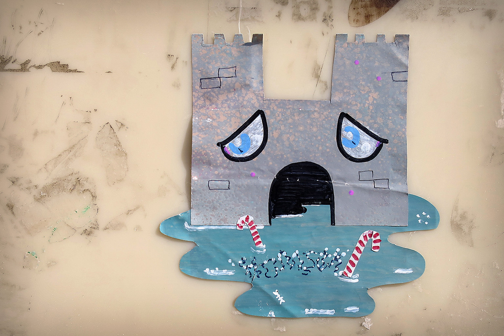

Tuesday, 3 May 2016
Paint on Brick
 |
| 106 Cartier Street |
This green works well enough with the dark roof and white trim. It makes the upthrusting shrubs (cypress?) and vertiginous side-staircase appear to sink into the architecture. The flattened roof-top is probably original, though older photos (geoOttawa 1958-1991) show light-coloured shingles.
The house is typical of the many two-and-a-half storey, red-brick-on-a-limestone-base, asymmetrical, dawn-of-the-20th homes one finds in Centretown and Sandy Hill. I'm having trouble dating it, what with some ambiguities in the City Directories and revision-date issues on the Goad maps. The 1901 Directory indicates "vacant lots" between a "House" at or near Lewis and #110 at Waverley. The 1909 edition lists an Archibald K. McLean at #106. 1909 doesn't name spouses or indicate ownership, but it looks as if Mr. McLean could well have been the first occupant and likely owner some time after 1901.
 | |
| from Goad; Ottawa Vol. 1, sheet 68 "reprint May 1912" |
This Goad map shows #106, mid-block between Lewis and Waverley on the west side of Cartier. The row houses across the street have been replaced by 99 Cartier, a six-storey apartment building ("the Norwood") and the adjacent duplex (105-107) is now a parking lot. Earlier maps suggest that the area occupied by Minto Park was designated as such from the get-go, rather like Anglesea Square in Lowertown.
So many houses of this size and style have been divided into apartments (#106 boasts three mailboxes on its front porch) that it's hard to picture them as single family, or indeed single person dwellings. But they were.
Some time between 1909 and 1913, Mr. McLean vacated the house and it was taken over by a Miss Elizabeth Kennedy. In 1914 Elizabeth was somehow replaced by Margaret of-like-surname, who continued to live there through the 20s, 30s and 40s, listed as the owner. She was eventually joined by her sister, Agnes Cornelia Kennedy, who died in September of 1944, leaving her estate to Margaret. Margaret R. Kennedy died in February of 1949, marking the end of a family occupancy that lasted through two World Wars, the intervening Jazz Age and the Great Depression.
I'm guessing that the steep staircase with its fiberglass canopy is the private approach to a small, third-storey apartment. The Golden Triangle hosts several examples of exterior access to upper-floor apartments. Some look far worse than this.
Friday, 15 April 2016
Little Shop
 |
| 315 Somerset East, Ottawa ON |
This oddity seems to have less floor-space than my own modest one-bedroom flat. The facade bespeaks a career in retail, the siding is recent and, I am confident, vinyl. I am less sure whether someone actually lives here. This house, if we can call it that, sits on the eastern, downhill stretch of Somerset East between Chapel St and Blackburn Ave — that little valley in the heart of what we aren't supposed to call the Ottawa U "student ghetto."
The valley is actually a fluvial channel, cut by the proto-Ottawa River, between two sandy terraces — "old" Sandy Hill to the north and the smaller Mann Avenue ridge to the south. This happened a very long time ago. Later, when the Rideau Canal was being built, a stream called Neville's Creek ran from a swampy patch of ground near Elgin St, eastward to the southern end of the Rideau Canal's "Deep Cut" at the southern tip of what is now the Ottawa U campus. It cascaded down to the now-corner of Mann and King Edward, thence toward now-Somerset, following the valley to now-Strathcona Park, emptying into what continues to be the Rideau River.

The topography on this portion of the Charles E. Goad fire insurance map (1902-'09) shows part of the ancient channel (Colonel By's "natural gully") as it crosses the chart from the southwest to the northeast. Anyone who has walked or driven the length of Somerset East will recognise the spectacular drop between Henderson and Sweetland, as Somerset dives into the channel. In this view, the roads of southern Sandy Hill have been surveyed but not necessarily built upon, and Mann Ave is still considered to be part of Gladstone.
The portion of Sandy Hill south of Laurier (then-Theodore) saw scant development before 1900, but experienced a building boom which spread roughly downhill from the northwest to the southeast during the first three decades of the 20th Century. By mid-century, the southward sprawl back uphill to Mann Ave was complete.
The large buildings to either side of #315 are visible in aerial photos from 1928, but poor resolution precludes a clear sighting of the little shop itself (for indeed, that's what it was.) We can see it in an image from thirty years later (highlighted here in green, image via geoOttawa.) The shop seems to cling to it's neighbour — in fact the two are separated by an air-gap of no more than a foot.

#315 made local news during January of 1945, when on the 19th of that month, the Ottawa Journal reported that...
"Pleading not guilty to a charge of breaking and entering the shop of Hiram Atcheson, 315 Somerset street east, and stealing $3 worth of of cigarettes, Raymond Allen, 18, of no fixed address, was remanded to January 26 for hearing, by Magistrate Strike this morning."Exactly three days later, the Journal would note that one Angelo Sirna, age 17, of nearby 31 Greenfield Ave had been arrested on the same charge having allegedly broken into the same store and stolen cigarettes in the same amount. I'm thinking that a) the two crimes were somehow related and b) Raymond ratted on Angelo.
And then there's this, from November of 1974...

Yes, some guys really did dress like that in 1974.
The Ottawa City Directories confirm that Hiram Atcheson operated a barbershop at #315 as early as 1941. It was then common enough for such shops to double as convenience-stores, selling candy, tobacco, sodas and such non-perishable doodads as lighters, pocket knives and nail clippers. For much of the '40s, Hiram and his wife Edna lived next to the shop at #313, actually a ground-floor rear apartment in the adjacent building at Somerset East and Chapel.
Atcheson moved out of #313 some time around 1950 but continued to cut hair at #315 until 1971, a tenure of at least thirty years. The shop sat vacant for a year or two until Gerard Levesque, his sideburns and his double-knits, briefly converted the shop into their campaign headquarters. A courier service assumed an equally short tenancy in 1975 and then a "home care"[?] company moved in and stayed until 1990. Thereafter, the Directories simply stop listing #315 altogether, up to the year 2000, the most recent edition held by the Ottawa Public Library.
Subscribe to:
Posts (Atom)